
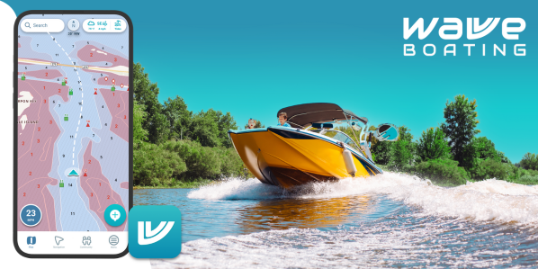
Boating has always required a strong understanding of navigation, weather, and water conditions. In the past, boaters relied on paper charts, compasses, and onboard electronics to safely travel waterways. Today, technology has simplified that process through powerful mobile tools known as marine navigation apps.
These apps bring together essential boating information into a single platform, helping boaters plan trips, navigate safely, and respond to changing conditions in real time. As a result, more people are turning to marine navigation apps as a core part of their boating routine.
What marine navigation apps actually do
Marine navigation apps are designed to help boaters understand where they are and where they are going. They combine GPS positioning with digital nautical charts, allowing users to see their exact location on the water.
Most apps also include features such as route planning, waypoint tracking, and speed monitoring. These tools help boaters stay on course and make adjustments when necessary.
Many modern apps go beyond basic navigation by including additional tools such as weather forecasts, tide data, and hazard alerts.
Key features that improve boating safety
One of the biggest advantages of marine navigation apps is the ability to combine multiple data sources into one interface.
Common features include:
- Digital charts that show depth, hazards, and navigation markers
- GPS tracking for real-time positioning
- Route planning tools for safer trip preparation
- Weather and tide forecasts for better decision-making
- Offline maps for use in low-signal areas
These features allow boaters to understand both their environment and their route, reducing the risk of accidents or navigation errors.
Some apps even include advanced capabilities such as depth mapping, waypoint marking, and sonar overlays, giving boaters a clearer picture of underwater terrain.
Making navigation easier for all boaters
Marine navigation apps are designed to be accessible for both beginners and experienced captains. Traditional navigation tools can be complex and require training to interpret correctly.
Modern apps simplify this process by presenting information visually. Instead of reading coordinates or interpreting symbols manually, boaters can see their position directly on a map and follow a planned route.
This ease of use helps new boaters build confidence while still providing advanced features for experienced users.
Planning trips before leaving the dock
One of the most valuable benefits of navigation apps is the ability to plan trips in advance. Boaters can explore waterways, measure distances, and identify hazards before they even reach the water.
Planning ahead helps reduce stress and allows for better decision-making during the trip. It also makes it easier to estimate fuel usage, travel time, and safe stopping points.
Route planning features often include waypoint creation, allowing boaters to mark important locations such as marinas, fishing spots, or anchorages.
Real-time data for smarter decisions
Conditions on the water can change quickly. Wind, waves, tides, and traffic can all affect how safe a route is at any given time.
Marine navigation apps often integrate real-time data directly into their maps. This allows boaters to adjust their plans as conditions change rather than reacting too late.
For example, a sudden increase in wind or wave height may prompt a change in route or timing. Having this information readily available improves overall safety.
Community insights and shared knowledge
Some marine navigation apps include community-driven features that allow users to share information with other boaters. This can include hazard reports, recommended routes, or points of interest.
Community data provides real-world insight that may not always be included in official charts. It can also help boaters discover new locations or avoid areas with known risks.
Platforms like KnowWake highlight how user-generated content can enhance navigation by adding local knowledge to digital maps.
Why marine navigation apps are becoming essential
As mobile technology continues to improve, marine navigation apps are becoming more powerful and widely used. Smartphones and tablets now offer high-resolution displays, reliable GPS tracking, and the ability to run advanced navigation software.
These apps are also more affordable and portable than traditional chartplotters, making them accessible to a wider range of boaters.
Many boaters now use navigation apps as primary tools or as backups to onboard systems, creating a more flexible navigation setup.
Navigating with confidence
Modern boating is all about preparation and awareness. Marine navigation apps help boaters understand their surroundings, plan safer routes, and respond to changing conditions.
By combining charts, GPS, weather data, and planning tools into one platform, these apps make navigation easier and more reliable.
Whether you are exploring new waterways or navigating familiar routes, having the right navigation tools can make every trip safer and more enjoyable.
