
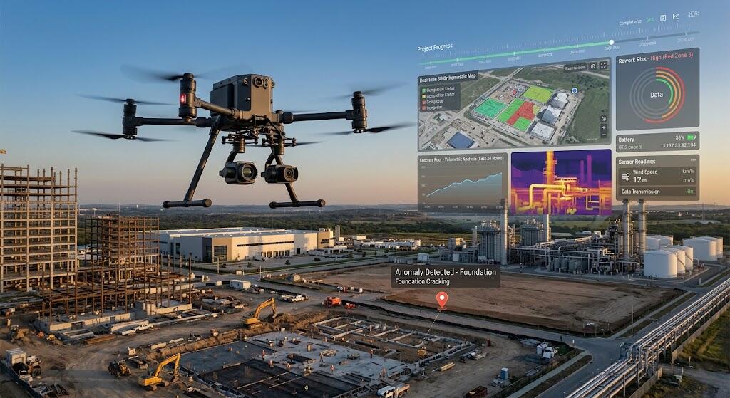
Drones once served as flying cameras. Today, AI-powered drone services act as aerial data platforms that capture, analyze, and report on physical assets with little manual effort.
Construction firms, real estate teams, and industrial operators now adopt these services for four reasons: faster data capture, safer inspections, lower costs, and insights that teams can act on immediately.
This guide explains how AI drone services work, where they deliver the most value, and how a business can adopt them.
What you will learn:
- The core use cases across three industries
- The AI capabilities that matter most
- Business benefits, costs, and ROI
- Compliance and data security essentials
- Criteria for choosing a provider
What Are AI-Powered Drone Services?
Definition and Core Concept
AI-powered drone services follow a drone-as-a-service (DaaS) model. They combine autonomous flight, high-resolution sensors, cloud processing, and machine-learning analytics.
Traditional drone photography produces images. Intelligent inspection produces answers, including automated defect detection, 3D models, thermal analysis, progress tracking, and predictive alerts.
A service provider typically manages the hardware, licensed pilots, flight planning, data processing, and reporting. Clients therefore avoid the cost of building an in-house drone program.
How the Technology Works
The process runs in four stages:
- Data capture: RGB cameras, thermal sensors, LiDAR, multispectral sensors, and specialized non-destructive testing payloads collect the data.
- Automated flight: Pre-programmed routes, obstacle avoidance, and repeatable missions keep results consistent.
- AI processing: Computer vision detects cracks, corrosion, moisture, hot spots, missing components, and safety violations. It also tracks change over time.
- Deliverables: Teams receive orthomosaic maps, 3D models, digital twins, defect inventories, and dashboards. Many providers also integrate with BIM, GIS, and asset-management systems.
Why AI Makes Drone Services More Valuable
From Raw Imagery to Decisions
A single inspection can produce thousands of images. AI sorts them into prioritized findings, which cuts manual review time sharply.
Automated classification and severity scoring help teams focus on the defects that matter most, such as cracks, leaks, corrosion, and surface damage.
Predictive Maintenance and Risk Prevention
Repeated missions build a historical baseline for each asset. AI compares new data against that baseline and flags deterioration trends before failures occur.
The business value is clear. Organizations see fewer emergency repairs, less downtime, and better maintenance scheduling.
Safety, Speed, and Scalability
Drones inspect roofs, towers, bridges, pipelines, and confined spaces. Workers no longer need to face height or hazardous conditions.
AI-enabled analysis also shortens reporting time compared with manual visual checks.
AI-Powered Drone Services in Construction
Site Surveying and Pre-Construction Planning
Drones support topographic surveys, terrain modeling, drainage assessment, and access-route planning. LiDAR and photogrammetry produce accurate 2D maps and 3D terrain models for design and earthwork planning.
Progress Monitoring and Project Controls
Recurring flights tie aerial capture to project milestones. Some sites use autonomous docks to run these missions on a schedule.
AI compares each flight with BIM models, schedules, and earlier flights. The comparison reveals delays, deviations, incomplete work, and changes in material stock.
Common use cases include:
- Earthwork volume calculations
- Stockpile measurement
- Equipment tracking
- Stakeholder reporting
Quality Control and Rework Prevention
High-resolution imagery exposes installation errors and deviations from plans early. Early detection reduces costly rework. It also creates documentation that supports claims or disputes.
Jobsite Safety and Compliance
AI can detect unsafe conditions, missing PPE, blocked access routes, unstable structures, and environmental hazards. Aerial monitoring then supports safety audits and regulatory records.
Typical construction deliverables include orthomosaic maps, progress reports, time-lapse videos, cut and fill reports, safety heatmaps, and BIM or GIS-ready data packages.
AI-Powered Drone Services in Real Estate
Premium Property Marketing
Cinematic aerial photos, 4K video, virtual tours, and neighborhood flyovers help listings stand out. They work for residential, commercial, and industrial properties.
AI-assisted editing, automated video creation, and image enhancement speed up the production of listing-ready asset packages.
Land, Lot, and Development Visualization
Aerial data supports boundary overlays, lot dimensions, zoning context, and proposed-development visualizations. These tools add value for land sales, master-planned communities, resorts, agricultural parcels, and commercial sites.
Property Condition and Roof Inspections
Drones capture roofs, façades, and storm damage for insurance documentation. Thermal imaging reveals moisture and insulation problems.
AI defect detection speeds up due diligence for buyers, investors, insurers, and property managers.
Marketing for Developers
Developers use drone progress updates to market pre-construction projects and reassure investors. Useful content includes monthly construction updates, before-and-after comparisons, aerial time-lapses, and investor dashboards.
AI-Powered Drone Services in Industrial Inspections
Power and Utilities
Drones inspect transmission towers, power lines, substations, wind turbines, and solar farms. Thermal imaging locates electrical hot spots, while AI detects corrosion and damaged components. Vegetation and right-of-way monitoring complete the picture.
Oil, Gas, Pipelines, and Chemical Facilities
Operators monitor pipelines, storage tanks, refineries, flare stacks, and remote assets from the air. AI identifies leak indicators, corrosion, insulation loss, structural damage, and unauthorized encroachment.
Bridges, Roads, Rail, and Public Infrastructure
Drones detect cracks, concrete spalling, steel corrosion, pavement damage, and drainage issues. Digital inspection records then support capital planning and maintenance budgets.
Manufacturing Plants, Warehouses, and Ports
Facilities use drones for roof and façade inspections, inventory visibility, yard management, security monitoring, and thermal equipment checks. Recurring autonomous flights turn one-off inspections into continuous facility intelligence.
Industrial deliverables often include defect registers, thermal anomaly reports, 3D asset models, work-order-ready findings, and audit documentation.
Key AI Capabilities at a Glance
| AI capability | What it does | Primary industry value |
| Computer-vision defect detection | Identifies cracks, corrosion, leaks, and anomalies | Industrial inspections, construction QC |
| Thermal analytics | Detects heat loss, moisture, and electrical hot spots | Real estate, utilities, facilities |
| Photogrammetry and 3D reconstruction | Creates maps, models, and measurements | Construction, land development |
| Change detection | Compares flights to show progress or deterioration | Construction, infrastructure |
| Predictive analytics | Forecasts maintenance needs from recurring data | Industrial asset management |
| Automated reporting | Converts findings into prioritized reports | All industries |
Business Benefits of AI Drone Services
- Lower inspection costs: Teams need less scaffolding, access equipment, manual labor, and logistics.
- Improved safety: Fewer workers face heights, live electrical equipment, or hazardous environments.
- Faster turnaround: Operators inspect large assets more often and analyze results quickly.
- Better data accuracy: High-resolution imagery, LiDAR, and 3D models support precise measurement.
- Stronger documentation: Time-stamped visual evidence improves accountability, compliance, and insurance claims.
- Sustainability gains: Fewer inspection trips reduce vehicle use and environmental impact.
From Flight to Insight: A Typical Workflow
- Define the objective: Choose progress tracking, marketing, roof inspection, thermal audit, or asset assessment.
- Plan the mission: Select sensors, flight paths, frequency, safety zones, and deliverables.
- Capture aerial data: Licensed pilots or autonomous systems collect imagery and sensor data.
- Process with AI: Computer-vision models detect defects, measure change, and classify findings.
- Review and validate: Qualified engineers confirm the critical findings.
- Deliver insights: Reports, dashboards, and 3D models reach project or maintenance systems.
- Act and re-monitor: Teams schedule repairs and compare the next flight against the baseline.
Costs, ROI, and Service Models
Common Pricing Models
- Per-flight or per-project pricing
- Hourly rates for capture and processing
- Monthly or quarterly subscriptions
- Recurring milestone-based construction packages
- Enterprise contracts for multi-site programs
Typical Cost Ranges
Construction drone services commonly range from about $150 to $400 per hour for basic progress photography. Advanced 3D mapping or volumetric surveying often costs $250 to $600 per hour. Actual pricing varies with location, sensors, deliverables, and project complexity.
The DaaS model also removes upfront spending on hardware, pilot training, insurance, and compliance management.
How to Calculate ROI
Compare the service cost against avoided scaffolding, manual labor, downtime, travel, rework, and late defect discovery. Use this simple formula:
ROI (%) = (Cost savings + Avoided losses − Drone service cost) ÷ Drone service cost × 100
Strong ROI drivers include fewer safety incidents, earlier defect detection, faster project decisions, and reduced unplanned maintenance.
Compliance, Safety, and Data Security
Regulatory Requirements
Commercial drone operations usually require certified pilots, aircraft registration where applicable, airspace authorization, and adherence to local aviation rules. Reputable providers manage pilot certification, registered aircraft, and data workflows from end to end.
Safety Protocols
Good providers run pre-flight risk assessments, set geofences and weather thresholds, prepare emergency procedures, and coordinate with site personnel.
AI should assist qualified humans and never replace them on safety-critical findings.
Data Privacy and Cybersecurity
Providers must address consent for capturing neighboring properties, facial-recognition limits, secure cloud storage, access controls, and retention policies. Clients should keep ownership of their data.
Ask every provider where the data is processed, who can access it, and how it connects securely to internal systems.
How to Choose a Provider
- Industry expertise: Look for proven experience in your sector.
- Sensor fit: Confirm access to RGB, thermal, LiDAR, multispectral, or specialized payloads.
- AI transparency: Ask how the provider detects defects, validates accuracy, and reviews critical findings.
- Deliverable quality: Request sample orthomosaics, 3D models, reports, and dashboard demos.
- Integration capability: Check compatibility with BIM, GIS, Procore, Autodesk Construction Cloud, and CMMS platforms.
- Compliance and insurance: Verify pilot credentials, aviation compliance, liability coverage, and security practices.
- Scalability: Choose a provider that supports recurring missions and multiple sites.
Future Trends in AI Drone Services
- Autonomous drone docks: Scheduled monitoring runs without a pilot on site.
- Digital twins: Recurring flights keep live 3D replicas of assets current.
- Edge AI: Drones detect hazards and defects during flight and send faster alerts.
- Multimodal inspection: Visual, thermal, LiDAR, acoustic, and NDT data combine for fuller assessments.
- Deeper integration: Findings create maintenance tickets, BIM issues, and executive dashboards automatically.
- Wider adoption: Demand grows across utilities, infrastructure, agriculture, defense, and emergency response.
Frequently Asked Questions
What is an AI-powered drone service?
It uses drones and artificial intelligence to capture aerial data and identify defects, progress changes, thermal anomalies, and safety risks automatically.
Are AI drone inspections accurate?
They can be highly accurate with the right sensors, repeatable flight plans, and human validation. Accuracy depends on sensor quality, flight conditions, and model training.
Can drones inspect roofs and façades?
Yes. They reach roofs, façades, and towers while keeping workers off high structures.
How often should construction sites be flown?
Weekly, biweekly, or milestone-based schedules work well, depending on project pace and reporting needs.
Do drone services replace human inspectors?
No. AI speeds up detection and documentation, but qualified professionals should validate critical findings.
Is drone data useful for real estate marketing?
Yes. Aerial photos, video, boundary overlays, and development visualizations make listings more informative and compelling.
Conclusion
AI-powered drone services now go far beyond aerial photography. They give construction, real estate, and industrial teams a practical way to improve safety, speed, documentation, and decision quality.
Businesses that start with one clear use case, such as a progress-monitoring program or a roof inspection, can measure results quickly and then expand across more sites.
